
Niantic Spatial's Large Geospatial Model: A Technical Deep Dive
Executive Summary
Niantic Spatial has developed a Large Geospatial Model (LGM) trained on approximately 30 billion crowdsourced images from Pokémon Go and Ingress players, creating a Visual Positioning System (VPS) capable of localizing a device to within a few centimeters using only a handful of visual snapshots.
- The model leverages millions of precisely tagged “hotspot” locations with multi-angle, multi-condition imagery and rich IMU metadata to enable visual positioning where GPS fails in urban canyons.
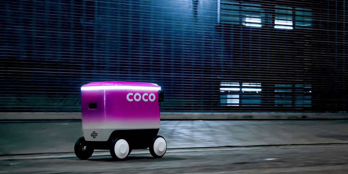
- First commercial deployment with Coco Robotics equips sidewalk delivery robots with hip-height multi-camera systems for centimeter-accurate pickup and drop-off positioning.
- Architecture combines large-scale visual feature learning with geospatial grounding, effectively turning eight years of AR gameplay into a foundational world model for robotics and AR.
- This represents one of the largest real-world visual localization datasets ever used in production, shifting the “audience” for AR technology from human players to autonomous robots.
Technical Architecture
Niantic Spatial’s system is a Visual Positioning System built on a Large Geospatial Model. At its core, the LGM learns to map raw camera images directly to precise 6-DoF (degree-of-freedom) poses in a global coordinate frame.
The training corpus is uniquely dense. Niantic harvested data from over 500 million installs of Pokémon Go in its first 60 days and more than 100 million monthly active users as late as 2024. Gameplay mechanics funneled players to more than one million “Points of Interest” (PoIs) — PokéStops, Gyms, and Ingress portals — where the game required precise localization and camera orientation. For each PoI, the company accumulated thousands of images captured from slightly different positions, times of day, seasons, and weather conditions. Each image is accompanied by high-fidelity metadata: latitude/longitude (derived from phone GPS + visual corrections), 3-axis orientation, device tilt, velocity vector, and timestamp.
This produces a dataset of ~30 billion images clustered around these hotspots. The model is trained to solve a visual localization task: given one or more query images, regress the camera’s 6-DoF pose relative to a pre-built 3D geospatial map. The architecture is not publicly detailed, but industry patterns and the problem description suggest a hybrid approach:
- A large vision backbone (likely a variant of ResNet, EfficientNet, or Vision Transformer) extracts dense local features and global descriptors from query images.
- These features are matched against a massive geospatial feature database or implicitly encoded within the model weights.
- An IMU fusion head integrates phone motion data when available, though the primary claim is vision-only centimeter accuracy.
- A final pose regression or PnP (Perspective-n-Point) solver outputs the 6-DoF estimate.
Because the model generalizes beyond the original PoIs, it functions as a “world model” that can localize in nearby streets and buildings not directly visited during gameplay. This generalization is critical for last-mile robotics, where delivery addresses are rarely exactly at a PokéStop.
For Coco Robotics integration, the robots carry four cameras mounted at hip height pointing in different directions. Although this creates a different viewpoint distribution than a human holding a phone at eye level, Niantic reports the adaptation was straightforward, likely involving viewpoint-invariant feature learning and domain adaptation techniques during fine-tuning.
Performance Analysis
Niantic claims the system achieves localization accuracy “within a few centimeters” using only a handful of snapshots. This is a significant improvement over consumer GPS, which the article notes can drift by 50 meters in urban canyons due to multipath effects.
No independent third-party benchmarks have been released yet. However, the scale of the training data (30 billion images) dwarfs most academic visual localization datasets such as Cambridge Landmarks, 7Scenes, or even larger ones like Mapillary and Aachen Day-Night. Traditional visual localization methods (e.g., COLMAP, NetVLAD, or hierarchical localization pipelines) typically require explicit 3D reconstruction per area. Niantic’s end-to-end learned approach promises greater scalability and robustness to appearance changes (day/night, weather, seasonal foliage).
Comparative context with competitors:
| Company | Approach | Accuracy Claimed | Dataset Scale | Primary Limitation |
|---|---|---|---|---|
| Niantic Spatial | Learned LGM + VPS | ~few cm (vision-only) | 30B images, 1M+ PoIs | Generalization beyond hotspots |
| Starship Technologies | Classical 3D mapping + sensors | Not disclosed | Proprietary per-city | Requires explicit mapping per route |
| Coco Robotics (pre) | GPS + basic vision | 50m+ drift in cities | N/A | Unreliable in urban canyons |
The key performance differentiator is robustness in “urban canyons” and the ability to operate without building per-city 3D maps from scratch. Because the model has seen millions of real-world conditions, it should exhibit strong invariance to lighting, weather, and minor scene changes — critical for robots operating in all weather across seasons.
Technical Implications
This announcement marks a notable shift in how large-scale real-world data is being repurposed for AI. What began as gameplay telemetry has become one of the largest labeled visual localization datasets on the planet. The same underlying technology that made Pikachu appear to stand realistically on a park bench now helps a delivery robot stop precisely at a customer’s doorstep.
For the robotics ecosystem, it offers a potential “foundation model” for localization, analogous to how pre-trained LLMs accelerated natural language tasks. Delivery, inspection, and last-mile logistics companies could license the Niantic Spatial API instead of investing years in building their own high-definition maps.
The technology also has implications for AR glasses and autonomous vehicles. A centimeter-accurate visual positioning layer is a prerequisite for convincing mixed-reality overlays and for safe low-speed autonomous navigation on sidewalks. By pivoting from consumer AR gaming to enterprise geospatial AI, Niantic is effectively productizing its eight-year data moat.
Limitations and Trade-offs
Several limitations remain:
- Privacy and consent: The 30 billion images were collected from players who installed Pokémon Go primarily for entertainment. While location data was core to the game, repurposing it for commercial AI training has raised ethical questions in related coverage.
- Geographic bias: Accuracy is highest near the original one million PoIs. Performance in rural areas, new construction zones, or rapidly changing urban environments may degrade.
- Viewpoint shift: Robot cameras are lower and have different fields of view. Although Niantic says adaptation was straightforward, long-term robustness to occlusions (pedestrians, parked cars, temporary construction) is unproven at scale.
- Lack of public benchmarks: Without independent evaluation on standard visual localization metrics (recall@1m, recall@0.25m, median translation error), the “few centimeters” claim remains a black-box marketing figure.
- Regulatory risk: Sidewalk robots already face complex local regulations; reliance on a third-party model introduces supply-chain and uptime dependencies.
Expert Perspective
From a technical standpoint, Niantic Spatial’s achievement is significant not because visual positioning is new, but because of the unprecedented scale and quality of the training data. Few organizations have access to hundreds of millions of real-world, precisely tagged, multi-temporal images with IMU ground truth. This gives Niantic a genuine data advantage that is difficult for competitors to replicate without similar long-running consumer AR applications.
The move from AR gaming to robotics foundation models mirrors broader industry trends: data collected for one purpose (engaging gameplay) becomes the fuel for high-value enterprise AI. If the few-centimeter accuracy holds up under independent scrutiny and scales to new cities, this could accelerate deployment of reliable autonomous delivery fleets and reduce the cost of creating HD maps for urban robotics.
The deeper implication is that we are witnessing the birth of “geospatial foundation models” — large neural networks that encode the visual structure of the physical world in a way that is queryable by robots, AR devices, and potentially autonomous vehicles. Niantic’s early lead in this domain, built on Pokémon Go’s global footprint, may prove more strategically valuable than the original game’s revenue.
Technical FAQ
### How does Niantic’s accuracy compare to classical visual SLAM or NetVLAD-based localization?
Classical SLAM systems achieve high accuracy in small-scale, static environments but struggle with long-term appearance change and scale. Learned approaches like Niantic’s LGM are designed for global-scale localization with invariance to lighting and seasons. The claimed few-centimeter performance would be state-of-the-art for wide-area visual localization, though independent verification is still pending.
### Can the model operate entirely without GPS, and what is the fallback strategy?
The article indicates the primary value is in GPS-denied urban canyons, suggesting the vision model can run independently. In practice, most deployments will likely use loose GPS coupling for coarse localization followed by visual refinement, with IMU for short-term dead reckoning.
### Is the model available via API, and what is the inference latency on robot hardware?
Niantic Spatial has launched a platform for licensing the technology. Specific API details and latency numbers have not been disclosed. Given the model size implied by 30 billion training images, edge inference may require model distillation or cloud offloading for smaller robots.
### How does this compare to Tesla’s or Mobileye’s visual mapping efforts?
Tesla and Mobileye focus primarily on driving environments using vehicle-mounted cameras at road level. Niantic’s data is pedestrian-centric, sidewalk-level, and covers a much broader set of global urban micro-locations. The two approaches are complementary rather than directly competitive.
Sources
- How Pokémon Go is giving delivery robots an inch-perfect view of the world
- Gotta Catch 'Em All: How Pokémon Go covertly captured your data for years to train a massive AI model
- Pokémon Go Players Have Unwittingly Trained AI to Navigate the World
- Pokemon Go Made Niantic Billions. Now It’s Ditching Gaming For AI.
- Pokémon Go Players Have Been Training an AI to Auto-Complete the Real World